
Olmsted topographic map
Interactive map
Click on the map to display elevation.
About this map
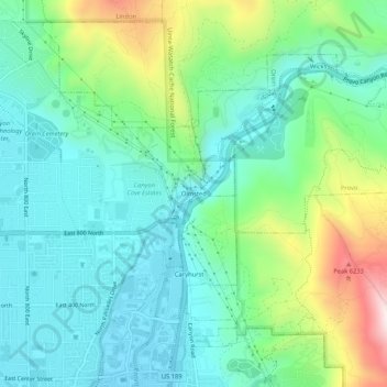
Name: Olmsted topographic map, elevation, terrain.
Location: Olmsted, Orem, Utah County, Utah, 84604, United States (40.29607 -111.67404 40.33607 -111.63404)
Average elevation: 1,594 m
Minimum elevation: 1,448 m
Maximum elevation: 1,991 m