
River Des Peres topographic map
Interactive map
Click on the map to display elevation.
About this map
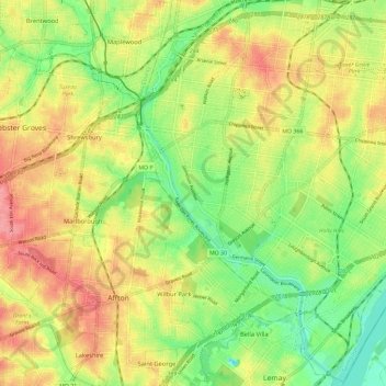
Name: River Des Peres topographic map, elevation, terrain.
Average elevation: 153 m
Minimum elevation: 110 m
Maximum elevation: 197 m
Other topographic maps
Click on a map to view its topography, its elevation and its terrain.
Luxemburg
United States > Missouri > Saint Louis County > Lemay
Luxemburg, Lemay, Saint Louis County, Missouri, 63111, United States
Average elevation: 136 m