
Hooker Lake topographic map
Interactive map
Click on the map to display elevation.
About this map
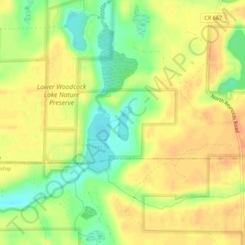
Name: Hooker Lake topographic map, elevation, terrain.
Average elevation: 252 m
Minimum elevation: 228 m
Maximum elevation: 267 m
Other topographic maps
Click on a map to view its topography, its elevation and its terrain.
Frankfort
United States > Michigan > Benzie County
Frankfort, Benzie County, Michigan, United States
Average elevation: 194 m
Elberta
United States > Michigan > Benzie County > Elberta
Elberta, Gilmore Township, Benzie County, Michigan, 49628, United States
Average elevation: 187 m