
Thank you for supporting this site ❤️
Make a donation
Make a donation
Petham topographic map
Click on the map to display elevation.
Thank you for supporting this site ❤️
Make a donation
Make a donation
About this map
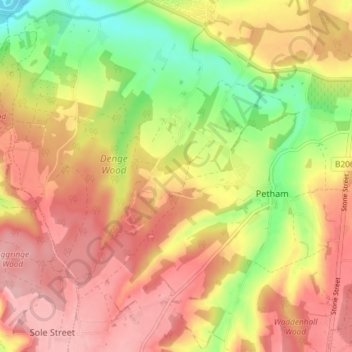
Name: Petham topographic map, elevation, terrain.
Location: Petham, Canterbury, Kent, England, United Kingdom (51.20548 0.99030 51.24472 1.06393)
Average elevation: 96 m
Minimum elevation: 19 m
Maximum elevation: 152 m
Thank you for supporting this site ❤️
Make a donation
Make a donation