
Umurbey topographic map
Interactive map
Click on the map to display elevation.
About this map
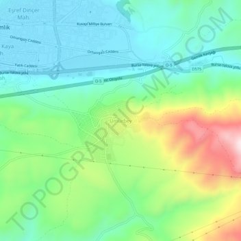
Name: Umurbey topographic map, elevation, terrain.
Location: Umurbey, Gemlik, Bursa, Marmara Region, Turkey (40.39462 29.16337 40.43462 29.20337)
Average elevation: 154 m
Minimum elevation: 2 m
Maximum elevation: 504 m
Other topographic maps
Click on a map to view its topography, its elevation and its terrain.