
Klippitztörl topographic map
Interactive map
Click on the map to display elevation.
About this map
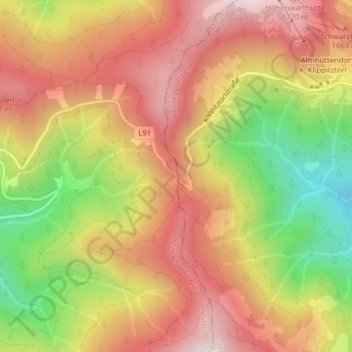
Name: Klippitztörl topographic map, elevation, terrain.
Average elevation: 1,541 m
Minimum elevation: 1,211 m
Maximum elevation: 1,789 m
Passhöhe
Other topographic maps
Click on a map to view its topography, its elevation and its terrain.
Zosen
Österreich > Kärnten > Bezirk Sankt Veit an der Glan > Hüttenberg
Zosen, Hüttenberg, Bezirk Sankt Veit an der Glan, Kärnten, 9375, Österreich
Average elevation: 1,084 m