
Tepebaşı Mahallesi topographic map
Interactive map
Click on the map to display elevation.
About this map
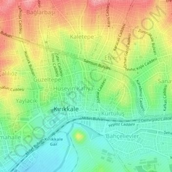
Name: Tepebaşı Mahallesi topographic map, elevation, terrain.
Location: Tepebaşı Mahallesi, Kırıkkale, Central Anatolia Region, Turkey (39.84035 33.50739 39.84900 33.51212)
Average elevation: 741 m
Minimum elevation: 697 m
Maximum elevation: 799 m
Other topographic maps
Click on a map to view its topography, its elevation and its terrain.
Etiler Mahallesi
Etiler Mahallesi, Kırıkkale, Central Anatolia Region, Turkey
Average elevation: 803 m
Kaletepe Mahallesi
Kaletepe Mahallesi, Kırıkkale, Central Anatolia Region, Turkey
Average elevation: 796 m