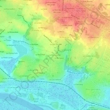
Le Bois Laurent topographic map
Interactive map
Click on the map to display elevation.
About this map
Name: Le Bois Laurent topographic map, elevation, terrain.
Average elevation: 28 m
Minimum elevation: -1 m
Maximum elevation: 66 m

Click on the map to display elevation.
Name: Le Bois Laurent topographic map, elevation, terrain.
Average elevation: 28 m
Minimum elevation: -1 m
Maximum elevation: 66 m