
Make a donation
Rideau Canal topographic map
Click on the map to display elevation.
Make a donation
Rideau Canal
Most of the locks are still hand-operated. There are a total of 45 locks at 23 stations along the canal, plus two locks (locks 33 and 34) at the entrance to the Tay Canal (leading to Perth). The elevation between the Ottawa River and its summit at Upper Rideau Lake, is 83 metres (273 feet), the elevation change from Upper Rideau Lake to Lake Ontario is 50 metres (164 feet). Furthermore, there are four blockhouses and some of the original 16 defensible lockmasters residences along the waterway. The original Commissariat Building and foundation of the Royal Engineers' barracks remain at the Ottawa Lock Station. The waterway is home to many species of birds, reptiles, amphibians, mammals and fish.
Make a donation
About this map
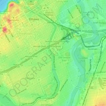
Name: Rideau Canal topographic map, elevation, terrain.
Average elevation: 69 m
Minimum elevation: 44 m
Maximum elevation: 99 m
Make a donation
Other topographic maps
Click on a map to view its topography, its elevation and its terrain.
Make a donation
Make a donation
Make a donation
Make a donation
Make a donation
Make a donation
Make a donation
Make a donation
Make a donation
Make a donation