
Wallen topographic map
Interactive map
Click on the map to display elevation.
About this map
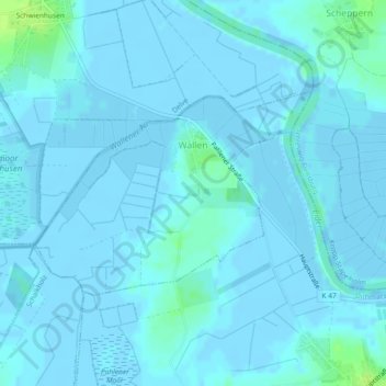
Name: Wallen topographic map, elevation, terrain.
Location: Wallen, Eider, Dithmarschen, Sleeswijk-Holstein, Duitsland (54.27434 9.25083 54.28863 9.28401)
Average elevation: 1 m
Minimum elevation: -3 m
Maximum elevation: 12 m
Other topographic maps
Click on a map to view its topography, its elevation and its terrain.
Heide
Duitsland > Sleeswijk-Holstein > Dithmarschen
Heide, Dithmarschen, Sleeswijk-Holstein, 25746, Duitsland
Average elevation: 5 m
Kleve
Duitsland > Sleeswijk-Holstein > Dithmarschen
Kleve, Eider, Dithmarschen, Sleeswijk-Holstein, Duitsland
Average elevation: 1 m