
上高县 topographic map
Interactive map
Click on the map to display elevation.
About this map
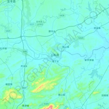
Name: 上高县 topographic map, elevation, terrain.
Location: 上高县, 敖阳街道, 上高县, 宜春市, 江西省, 中国 (28.07993 114.78239 28.39993 115.10239)
Average elevation: 83 m
Minimum elevation: 34 m
Maximum elevation: 721 m