
Thank you for supporting this site ❤️
Make a donation
Make a donation
Srirangam topographic map
Click on the map to display elevation.
Thank you for supporting this site ❤️
Make a donation
Make a donation
About this map
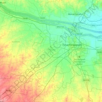
Name: Srirangam topographic map, elevation, terrain.
Location: Srirangam, Tiruchirappalli District, Tamil Nadu, India (10.64357 78.46307 10.92147 78.82463)
Average elevation: 94 m
Minimum elevation: 59 m
Maximum elevation: 165 m
Thank you for supporting this site ❤️
Make a donation
Make a donation