
Ngukurr topographic map
Interactive map
Click on the map to display elevation.
About this map
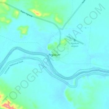
Name: Ngukurr topographic map, elevation, terrain.
Location: Ngukurr, Northern Territory, Australia (-14.77414 134.69234 -14.69414 134.77234)
Average elevation: 17 m
Minimum elevation: 4 m
Maximum elevation: 116 m