
Werther topographic map
Interactive map
Click on the map to display elevation.
About this map
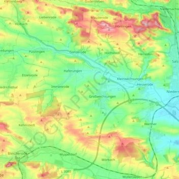
Name: Werther topographic map, elevation, terrain.
Location: Werther, Landkreis Nordhausen, Thüringen, 99735, Deutschland (51.44265 10.59482 51.55083 10.78577)
Average elevation: 234 m
Minimum elevation: 178 m
Maximum elevation: 330 m