
Thank you for supporting this site ❤️
Make a donation
Make a donation
Rabbit Ridge topographic map
Click on the map to display elevation.
Thank you for supporting this site ❤️
Make a donation
Make a donation
About this map
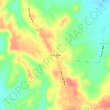
Name: Rabbit Ridge topographic map, elevation, terrain.
Location: Rabbit Ridge, Hopkins County, Kentucky, United States (37.27199 -87.71306 37.31199 -87.67306)
Average elevation: 137 m
Minimum elevation: 106 m
Maximum elevation: 171 m
Thank you for supporting this site ❤️
Make a donation
Make a donation
Other topographic maps
Click on a map to view its topography, its elevation and its terrain.