
Thank you for supporting this site ❤️
Make a donation
Make a donation
Wilton topographic map
Click on the map to display elevation.
Thank you for supporting this site ❤️
Make a donation
Make a donation
Wilton
According to the United States Census Bureau, the city has a total area of 1.95 square miles (5.05 km2), all land. The city sits at an elevation of 679 feet.
Thank you for supporting this site ❤️
Make a donation
Make a donation
About this map
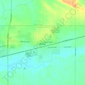
Name: Wilton topographic map, elevation, terrain.
Location: Wilton, Muscatine County, Iowa, United States (41.57991 -91.05745 41.59947 -91.00518)
Average elevation: 210 m
Minimum elevation: 197 m
Maximum elevation: 234 m
Thank you for supporting this site ❤️
Make a donation
Make a donation
Other topographic maps
Click on a map to view its topography, its elevation and its terrain.