
Kavaratti Island topographic map
Interactive map
Click on the map to display elevation.
About this map
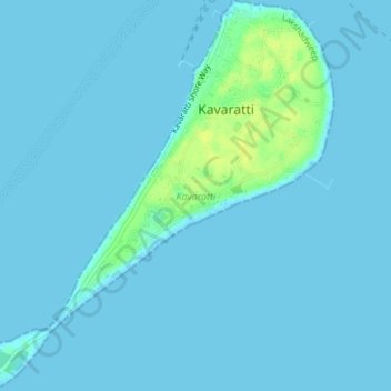
Name: Kavaratti Island topographic map, elevation, terrain.
Location: Kavaratti Island, Kavaratti, Lakshadweep, 262240, India (10.54073 72.61545 10.57747 72.64979)
Average elevation: 2 m
Minimum elevation: 0 m
Maximum elevation: 17 m
The island of Kavaratti lies 360 km (190 nmi) off the coast of the state of Kerala at 10°34′N 72°38′E / 10.57°N 72.64°E / 10.57; 72.64. It has an average elevation of 0 metres (0 feet).