
十都镇 topographic map
Interactive map
Click on the map to display elevation.
About this map
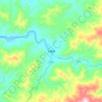
Name: 十都镇 topographic map, elevation, terrain.
Location: 十都镇, 炎陵县, 株洲市, 湖南省, 中国 (26.51031 113.89783 26.59031 113.97783)
Average elevation: 474 m
Minimum elevation: 256 m
Maximum elevation: 983 m
Other topographic maps
Click on a map to view its topography, its elevation and its terrain.