
Thank you for supporting this site ❤️
Make a donation
Make a donation
Satelite topographic map
Click on the map to display elevation.
Thank you for supporting this site ❤️
Make a donation
Make a donation
About this map
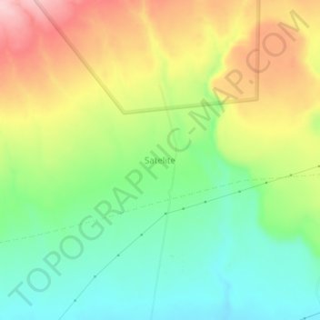
Name: Satelite topographic map, elevation, terrain.
Location: Satelite, Nakuru, Kenya (-1.00490 36.45420 -0.96490 36.49420)
Average elevation: 1,832 m
Minimum elevation: 1,740 m
Maximum elevation: 1,961 m
Thank you for supporting this site ❤️
Make a donation
Make a donation
Other topographic maps
Click on a map to view its topography, its elevation and its terrain.