
Thank you for supporting this site ❤️
Make a donation
Make a donation
Tebongkan topographic map
Click on the map to display elevation.
Thank you for supporting this site ❤️
Make a donation
Make a donation
About this map
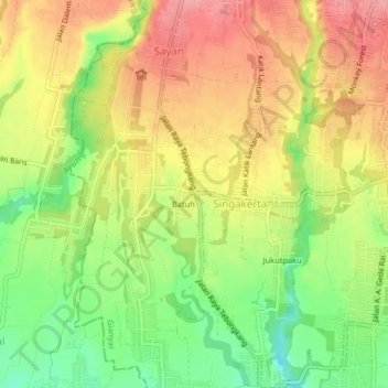
Name: Tebongkan topographic map, elevation, terrain.
Location: Tebongkan, Singakerta, Ubud, Gianyar, Bali, 80571, Indonesia (-8.54765 115.22336 -8.50765 115.26336)
Average elevation: 165 m
Minimum elevation: 111 m
Maximum elevation: 212 m
Thank you for supporting this site ❤️
Make a donation
Make a donation