
定方水乡 topographic map
Interactive map
Click on the map to display elevation.
About this map
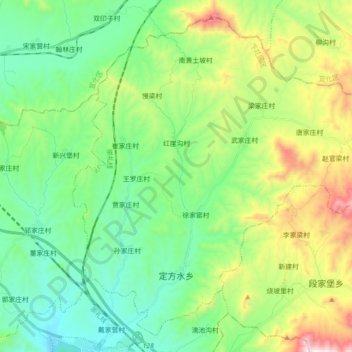
Name: 定方水乡 topographic map, elevation, terrain.
Location: 定方水乡, 下花园区, 张家口市, 河北省, 075100, 中国 (40.50788 115.26056 40.63045 115.43850)
Average elevation: 850 m
Minimum elevation: 548 m
Maximum elevation: 1,574 m
Other topographic maps
Click on a map to view its topography, its elevation and its terrain.