
Thank you for supporting this site ❤️
Make a donation
Make a donation
Kelurahan topographic map
Click on the map to display elevation.
Thank you for supporting this site ❤️
Make a donation
Make a donation
About this map
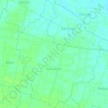
Name: Kelurahan topographic map, elevation, terrain.
Location: Kelurahan, Ngronggot, Nganjuk, East Java, Indonesia (-7.66637 112.04525 -7.62878 112.07496)
Average elevation: 47 m
Minimum elevation: 42 m
Maximum elevation: 51 m
Thank you for supporting this site ❤️
Make a donation
Make a donation
Other topographic maps
Click on a map to view its topography, its elevation and its terrain.
Thank you for supporting this site ❤️
Make a donation
Make a donation
Thank you for supporting this site ❤️
Make a donation
Make a donation