Höchstadt a.d.Aisch topographic map
Interactive map
Click on the map to display elevation.
About this map
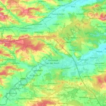
Name: Höchstadt a.d.Aisch topographic map, elevation, terrain.
Average elevation: 298 m
Minimum elevation: 257 m
Maximum elevation: 371 m

Click on the map to display elevation.
Name: Höchstadt a.d.Aisch topographic map, elevation, terrain.
Average elevation: 298 m
Minimum elevation: 257 m
Maximum elevation: 371 m