
宁蒗河 topographic map
Interactive map
Click on the map to display elevation.
About this map
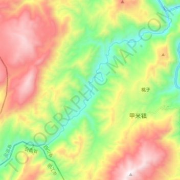
Name: 宁蒗河 topographic map, elevation, terrain.
Location: 宁蒗河, 甲米镇, 盐源县, 凉山彝族自治州, 四川省, 中国 (27.45666 100.89898 27.56231 101.03424)
Average elevation: 2,682 m
Minimum elevation: 2,010 m
Maximum elevation: 3,566 m