
Banstead topographic map
Interactive map
Click on the map to display elevation.
About this map
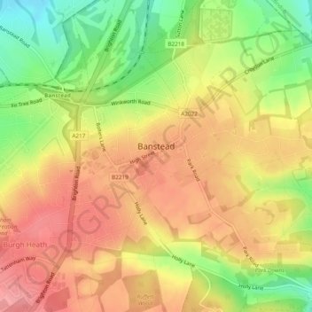
Name: Banstead topographic map, elevation, terrain.
Average elevation: 142 m
Minimum elevation: 88 m
Maximum elevation: 180 m
Other topographic maps
Click on a map to view its topography, its elevation and its terrain.
Merstham
United Kingdom > England > Surrey > Reigate and Banstead
Merstham, Reigate and Banstead, Surrey, England, RH1 3HT, United Kingdom
Average elevation: 119 m
Redhill
United Kingdom > England > Surrey > Reigate and Banstead
Redhill, Reigate and Banstead, Surrey, England, RH1 1RJ, United Kingdom
Average elevation: 107 m
Horley
United Kingdom > England > Surrey > Reigate and Banstead
Horley, Reigate and Banstead, Surrey, England, United Kingdom
Average elevation: 58 m