
蒲圻街道 topographic map
Interactive map
Click on the map to display elevation.
About this map
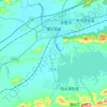
Name: 蒲圻街道 topographic map, elevation, terrain.
Location: 蒲圻街道, 赤壁市, 咸宁市, 湖北省, 中国 (29.63868 113.79087 29.75175 113.89161)
Average elevation: 67 m
Minimum elevation: 21 m
Maximum elevation: 424 m
Other topographic maps
Click on a map to view its topography, its elevation and its terrain.