
Thank you for supporting this site ❤️
Make a donation
Make a donation
Elleve topographic map
Click on the map to display elevation.
Thank you for supporting this site ❤️
Make a donation
Make a donation
About this map
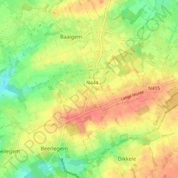
Name: Elleve topographic map, elevation, terrain.
Location: Elleve, Dikkelvenne, Gavere, Gent, Oost-Vlaanderen, 9630, België (50.89909 3.70841 50.93909 3.74841)
Average elevation: 42 m
Minimum elevation: 16 m
Maximum elevation: 63 m
Thank you for supporting this site ❤️
Make a donation
Make a donation