
Lavale District Park topographic map
Interactive map
Click on the map to display elevation.
About this map
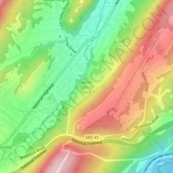
Name: Lavale District Park topographic map, elevation, terrain.
Average elevation: 324 m
Minimum elevation: 184 m
Maximum elevation: 484 m
Other topographic maps
Click on a map to view its topography, its elevation and its terrain.
Lucas Heights
United States > Maryland > Allegany County > La Vale > Lucas Heights
Lucas Heights, La Vale, Allegany County, Maryland, 21504, United States
Average elevation: 373 m