
Martinique topographic map
Interactive map
Click on the map to display elevation.
About this map
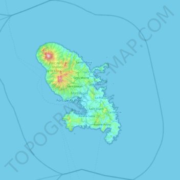
Name: Martinique topographic map, elevation, terrain.
Location: Martinique, France (14.22174 -61.43550 15.07951 -60.60228)
Average elevation: 22 m
Minimum elevation: 0 m
Maximum elevation: 1,339 m
Other topographic maps
Click on a map to view its topography, its elevation and its terrain.