
Береги topographic map
Interactive map
Click on the map to display elevation.
About this map
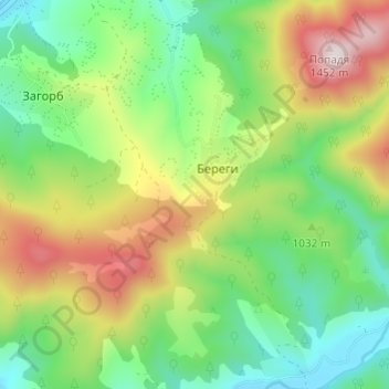
Name: Береги topographic map, elevation, terrain.
Location: Береги, Межгорский район, Закарпатская область, 90040, Украина (48.53487 23.68732 48.57487 23.72732)
Average elevation: 1,012 m
Minimum elevation: 764 m
Maximum elevation: 1,424 m