
Kelleys Island topographic map
Interactive map
Click on the map to display elevation.
About this map
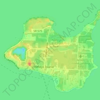
Name: Kelleys Island topographic map, elevation, terrain.
Location: Kelleys Island, Erie County, Ohio, 43438, United States (41.58529 -82.73512 41.62419 -82.67306)
Average elevation: 175 m
Minimum elevation: 161 m
Maximum elevation: 198 m