
Tepebaşı topographic map
Interactive map
Click on the map to display elevation.
About this map
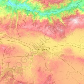
Name: Tepebaşı topographic map, elevation, terrain.
Location: Tepebaşı, Eskişehir, Central Anatolia Region, Turkey (39.62909 30.20844 40.02474 30.97209)
Average elevation: 885 m
Minimum elevation: 139 m
Maximum elevation: 1,680 m
Other topographic maps
Click on a map to view its topography, its elevation and its terrain.
Şirintepe Mahallesi
Şirintepe Mahallesi, Tepebaşı, Eskişehir, Central Anatolia Region, Turkey
Average elevation: 806 m