
Mechtat Boughareb topographic map
Interactive map
Click on the map to display elevation.
About this map
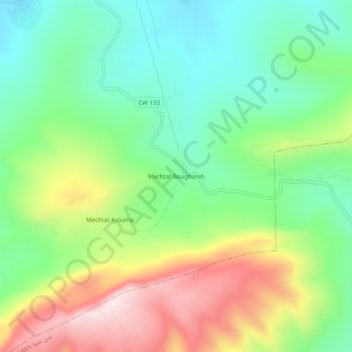
Name: Mechtat Boughareb topographic map, elevation, terrain.
Average elevation: 1,003 m
Minimum elevation: 816 m
Maximum elevation: 1,319 m
Other topographic maps
Click on a map to view its topography, its elevation and its terrain.
Djebel El Ouahch
Algérie > Constantine > Daïra Aïn Abid > Ibn Badis
Djebel El Ouahch, Ibn Badis, Daïra Aïn Abid, Constantine, Algérie
Average elevation: 1,100 m