
Vucht topographic map
Interactive map
Click on the map to display elevation.
About this map
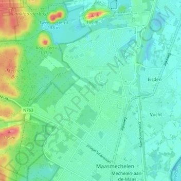
Name: Vucht topographic map, elevation, terrain.
Location: Vucht, Maasmechelen, Tongeren, Limburg, Vlaanderen, België (50.96877 5.66020 50.99782 5.73544)
Average elevation: 47 m
Minimum elevation: 30 m
Maximum elevation: 100 m
Other topographic maps
Click on a map to view its topography, its elevation and its terrain.
Uikhoven
België > Vlaanderen > Maasmechelen
Uikhoven, Maasmechelen, Tongeren, Limburg, Vlaanderen, 3631, België
Average elevation: 42 m