
Thank you for supporting this site ❤️
Make a donation
Make a donation
Kenli District topographic map
Click on the map to display elevation.
Thank you for supporting this site ❤️
Make a donation
Make a donation
About this map
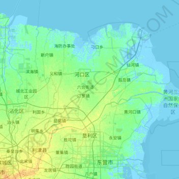
Name: Kenli District topographic map, elevation, terrain.
Location: Kenli District, Dongying, Shandong, 257500, China (37.41484 118.24855 38.05404 119.41452)
Average elevation: 4 m
Minimum elevation: -5 m
Maximum elevation: 24 m
Thank you for supporting this site ❤️
Make a donation
Make a donation
Other topographic maps
Click on a map to view its topography, its elevation and its terrain.