
Wolong District topographic map
Interactive map
Click on the map to display elevation.
About this map
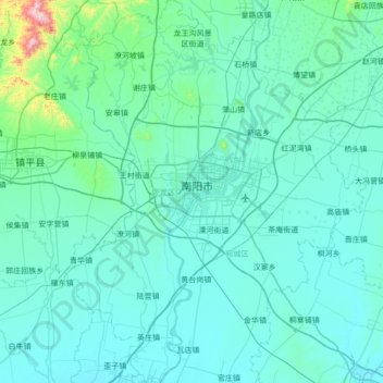
Name: Wolong District topographic map, elevation, terrain.
Location: Wolong District, Nanyang, Henan, China (32.70322 112.29285 33.27871 112.64166)
Average elevation: 156 m
Minimum elevation: 92 m
Maximum elevation: 1,011 m
Other topographic maps
Click on a map to view its topography, its elevation and its terrain.