
Thank you for supporting this site ❤️
Make a donation
Make a donation
Eizer topographic map
Click on the map to display elevation.
Thank you for supporting this site ❤️
Make a donation
Make a donation
About this map
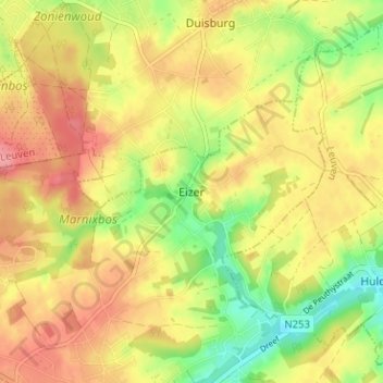
Name: Eizer topographic map, elevation, terrain.
Location: Eizer, Overijse, Hal-Vilvorde, Brabant flamand, 3080, Belgique (50.77855 4.53015 50.81855 4.57015)
Average elevation: 88 m
Minimum elevation: 43 m
Maximum elevation: 122 m
Thank you for supporting this site ❤️
Make a donation
Make a donation