
Le Moulin Simonneau topographic map
Interactive map
Click on the map to display elevation.
About this map
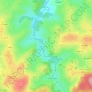
Name: Le Moulin Simonneau topographic map, elevation, terrain.
Average elevation: 406 m
Minimum elevation: 328 m
Maximum elevation: 513 m
Other topographic maps
Click on a map to view its topography, its elevation and its terrain.
La Rue Girard
France > Bourgogne-Franche-Comté > Yonne > Saint-Léger-Vauban
La Rue Girard, Saint-Léger-Vauban, Avallon, Yonne, Bourgogne-Franche-Comté, France métropolitaine, 89630, France
Average elevation: 411 m