
Igurubi topographic map
Interactive map
Click on the map to display elevation.
About this map
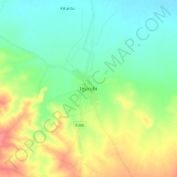
Name: Igurubi topographic map, elevation, terrain.
Location: Igurubi, Igunga, Tabora Region, Central Zone, Tanzania (-4.04058 33.67251 -3.96058 33.75251)
Average elevation: 1,095 m
Minimum elevation: 1,064 m
Maximum elevation: 1,148 m