
Thank you for supporting this site ❤️
Make a donation
Make a donation
Bhinar topographic map
Click on the map to display elevation.
Thank you for supporting this site ❤️
Make a donation
Make a donation
About this map
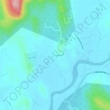
Name: Bhinar topographic map, elevation, terrain.
Location: Bhinar, Vasai, Palghar, Maharashtra, India (19.48563 72.96657 19.48788 72.96965)
Average elevation: 27 m
Minimum elevation: 0 m
Maximum elevation: 189 m
Thank you for supporting this site ❤️
Make a donation
Make a donation