
Ramsey County topographic map
Interactive map
Click on the map to display elevation.
About this map
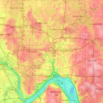
Name: Ramsey County topographic map, elevation, terrain.
Location: Ramsey County, Minnesota, USA (44.88728 -93.22784 45.12455 -92.98418)
Average elevation: 279 m
Minimum elevation: 207 m
Maximum elevation: 334 m
Other topographic maps
Click on a map to view its topography, its elevation and its terrain.