
Barangay 27 topographic map
Interactive map
Click on the map to display elevation.
About this map
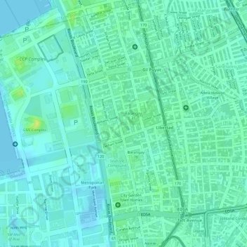
Name: Barangay 27 topographic map, elevation, terrain.
Average elevation: 7 m
Minimum elevation: -2 m
Maximum elevation: 21 m
Other topographic maps
Click on a map to view its topography, its elevation and its terrain.
Barangay 201
Barangay 201, Zone 20, District 1, Pasay, Southern Manila District, Metro Manila, Philippines
Average elevation: 19 m
Barangay 159
Barangay 159, Zone 17, District 2, Pasay, Metro Manila, Philippines
Average elevation: 9 m
Barangay 136
Barangay 136, Zone 13, District 2, Pasay, Southern Manila District, Metro Manila, Philippines
Average elevation: 9 m
Pasay
Pasay, District 1, Pasay, Metro Manila, 1300, Philippines
Average elevation: 14 m
Barangay 38
Barangay 38, Zone 5, Pasay, District 1, Pasay, Metro Manila, 1300, Philippines
Average elevation: 7 m