
Hersey Township topographic map
Interactive map
Click on the map to display elevation.
About this map
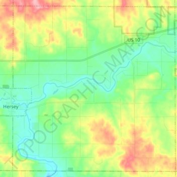
Name: Hersey Township topographic map, elevation, terrain.
Average elevation: 326 m
Minimum elevation: 287 m
Maximum elevation: 398 m
Other topographic maps
Click on a map to view its topography, its elevation and its terrain.
Evart
United States > Michigan > Osceola County
Evart, Osceola County, Michigan, United States
Average elevation: 316 m