
Schunnemunk State Park topographic map
Interactive map
Click on the map to display elevation.
About this map
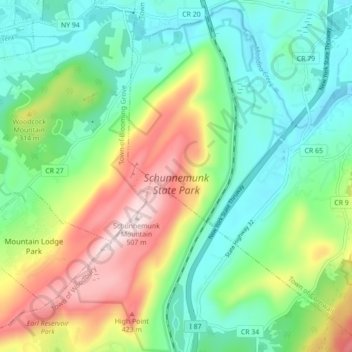
Name: Schunnemunk State Park topographic map, elevation, terrain.
Average elevation: 213 m
Minimum elevation: 66 m
Maximum elevation: 506 m
Other topographic maps
Click on a map to view its topography, its elevation and its terrain.
Highland Mills
United States > New York > Orange County > Village of Woodbury
Highland Mills, Village of Woodbury, Town of Woodbury, Orange County, New York, 10930, United States
Average elevation: 208 m
Central Valley
United States > New York > Orange County > Village of Woodbury
Central Valley, Village of Woodbury, Town of Woodbury, Orange County, New York, 10917, United States
Average elevation: 205 m