
善渓 topographic map
Interactive map
Click on the map to display elevation.
About this map
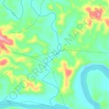
Name: 善渓 topographic map, elevation, terrain.
Location: 善渓, 桃江县, 安化县, 益阳市, 湖南省, 中国 (28.44917 111.65352 28.49189 111.66707)
Average elevation: 107 m
Minimum elevation: 48 m
Maximum elevation: 251 m