
Thank you for supporting this site ❤️
Make a donation
Make a donation
Mount Semeru topographic map
Click on the map to display elevation.
Thank you for supporting this site ❤️
Make a donation
Make a donation
About this map
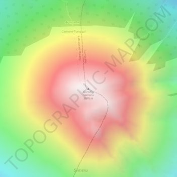
Name: Mount Semeru topographic map, elevation, terrain.
Location: Mount Semeru, Lumajang, East Java, Java, Indonesia (-8.10789 112.92243 -8.10779 112.92253)
Average elevation: 3,103 m
Minimum elevation: 2,482 m
Maximum elevation: 3,660 m
Thank you for supporting this site ❤️
Make a donation
Make a donation