
Pentwater Township topographic map
Interactive map
Click on the map to display elevation.
About this map
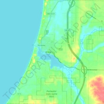
Name: Pentwater Township topographic map, elevation, terrain.
Location: Pentwater Township, Oceana County, Michigan, United States (43.73275 -86.47463 43.81950 -86.39792)
Average elevation: 188 m
Minimum elevation: 173 m
Maximum elevation: 238 m
Other topographic maps
Click on a map to view its topography, its elevation and its terrain.
Otto Township
United States > Michigan > Oceana County
Otto Township, Oceana County, Michigan, United States
Average elevation: 210 m
Shelby Township
United States > Michigan > Oceana County
Shelby Township, Oceana County, Michigan, 49455, United States
Average elevation: 261 m
Pentwater
United States > Michigan > Oceana County
Pentwater, Pentwater Township, Oceana County, Michigan, United States
Average elevation: 183 m