
Thank you for supporting this site ❤️
Make a donation
Make a donation
Point Blank topographic map
Click on the map to display elevation.
Thank you for supporting this site ❤️
Make a donation
Make a donation
About this map
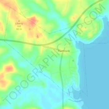
Name: Point Blank topographic map, elevation, terrain.
Location: Point Blank, San Jacinto County, Texas, United States (30.72957 -95.23451 30.75949 -95.19460)
Average elevation: 54 m
Minimum elevation: 39 m
Maximum elevation: 82 m
Thank you for supporting this site ❤️
Make a donation
Make a donation
Other topographic maps
Click on a map to view its topography, its elevation and its terrain.