
Thank you for supporting this site ❤️
Make a donation
Make a donation
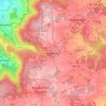
Ludwag topographic map
Click on the map to display elevation.
Thank you for supporting this site ❤️
Make a donation
Make a donation
Ludwag
Ludwag liegt auf einer Anhöhe an der Straße, die von Scheßlitz nach Heiligenstadt führt. Unterhalb der Ortschaft liegt ein ausgedehnter stillgelegter Kalksteinbruch. Auf einem Berg in der Nähe von Ludwag befindet sich die Wallfahrtskirche Gügel. Benachbarte Ortschaften sind Neudorf, Poxdorf, Kübelstein und Zeckendorf.
Thank you for supporting this site ❤️
Make a donation
Make a donation
About this map
Name: Ludwag topographic map, elevation, terrain.
Average elevation: 511 m
Minimum elevation: 339 m
Maximum elevation: 575 m
Thank you for supporting this site ❤️
Make a donation
Make a donation
Other topographic maps
Click on a map to view its topography, its elevation and its terrain.