
骆岗 topographic map
Interactive map
Click on the map to display elevation.
About this map
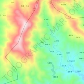
Name: 骆岗 topographic map, elevation, terrain.
Location: 骆岗, 麻城市, 黄冈市, 湖北省, 中国 (31.48708 114.99905 31.52708 115.03905)
Average elevation: 392 m
Minimum elevation: 175 m
Maximum elevation: 657 m
Other topographic maps
Click on a map to view its topography, its elevation and its terrain.